eryri / snowdonia


Parc Cenedlaethol Eryri: Snowdonia. Established in 1951, making it Britain’s 3rd National Park, covering 827 square miles, including coastline, rugged mountains, deep clear lakes and dense forests.
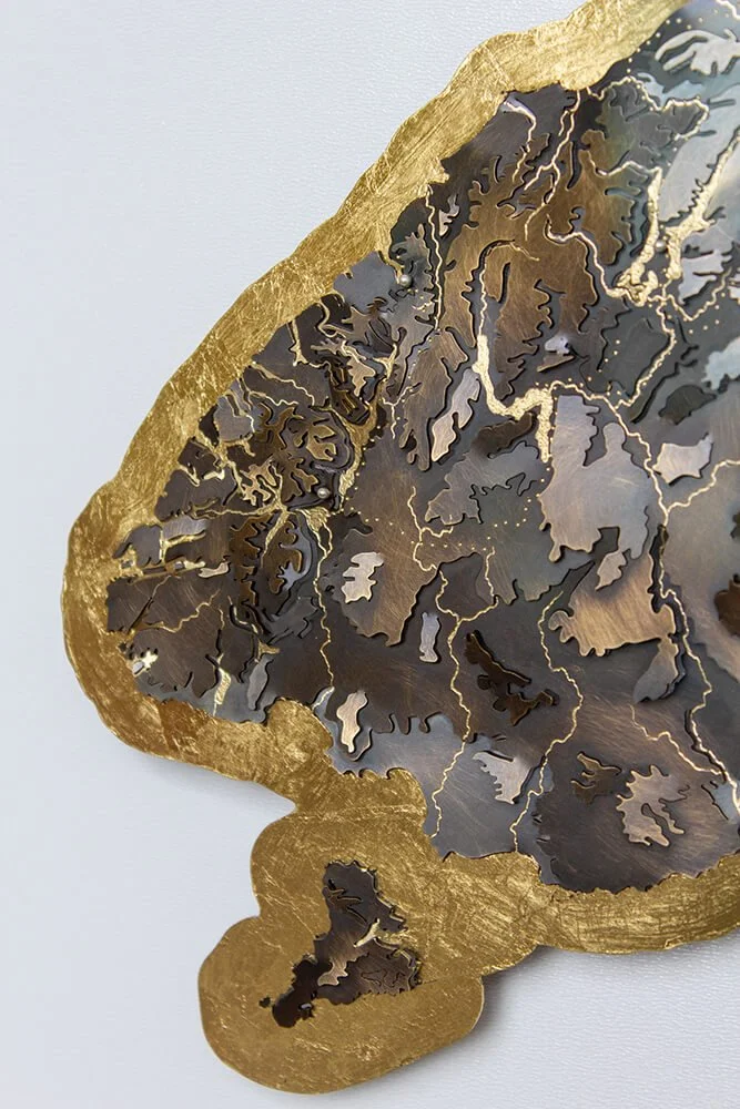
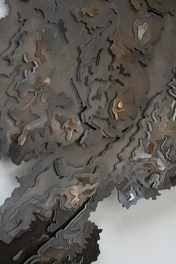
A wild landscape, captured in metal reflecting the slate greys of the Welsh stone cottages and trails underfoot.
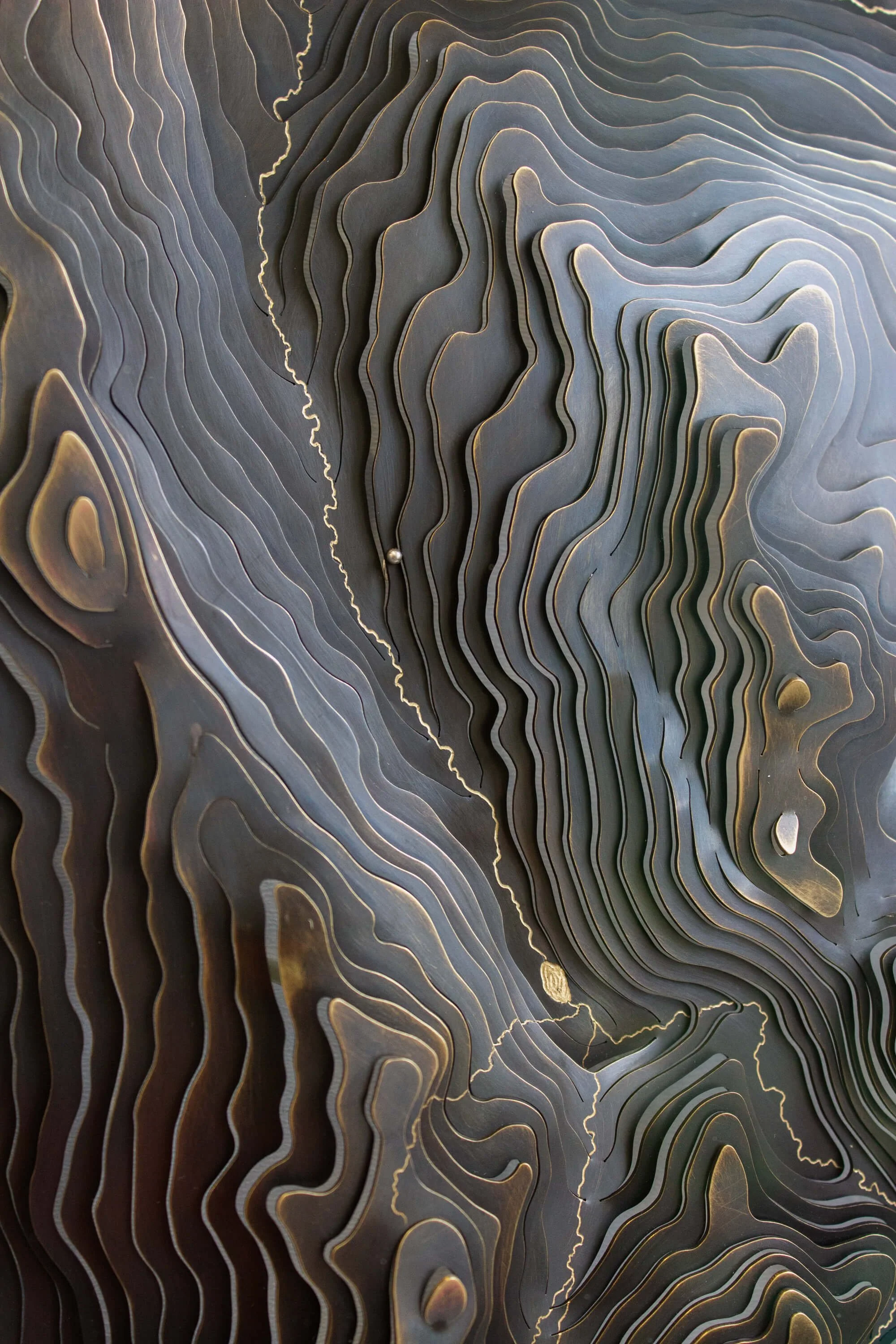
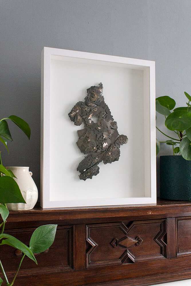
The map itself is made from brass, which has been blackened and slightly rubbed back in places to reveal a warm golden glow. It features the accurate topography of the park, using contours every 160m.
Keep things minimal with a plain map, or make your map tell your story, by choosing from a range of different personalisation options.
Engrave the river(s) within the map.
Mark favourite walking/running/biking/climbing trails.
Use silver, gold or stones to highlight particular locations, whether that be trigs, towns, holiday homes or another spot(s) that means something to you.
Engrave writing into the map, like coordinates, place names, dates, initials or messages.
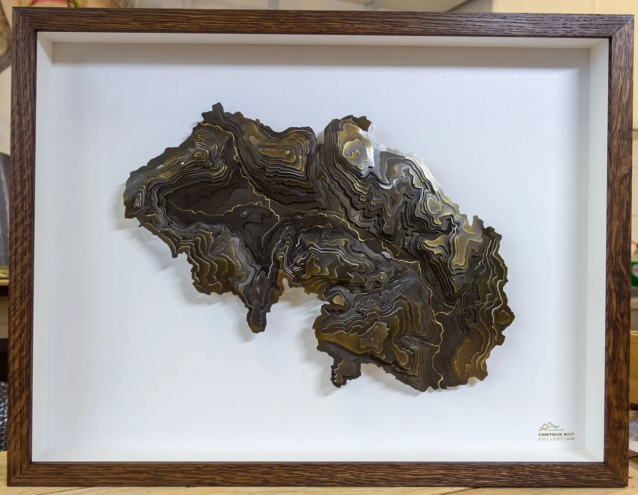
Map Finish
Choose between a blackened map on white background, or satin golden (brass) map on a black background.
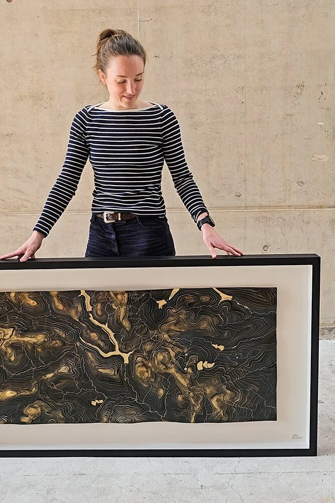
The map comes beautifully framed in a choice of white or black with Art Glass (non-reflective, dust-repellent), making it easy to gift or hang without hassle.
Price
Plain map / £1,100
+£60 rivers
+£20 up to 5 silver markers
+£50 up to 5 gold markers
Please contact Holly to discuss costs for stone set markers and engraved details.
Dimensions
Map dimensions - 23cm wide x 35cm tall*
Framed dimensions -
*If required, these can be adjusted to suit your needs.
Delivery / Collection
If you are local to Sheffield, you are welcome to collect from Holly’s city centre workshop.
Tracked delivery UK wide is included.
Lead times
Holly currently has one of these maps in stock, un-personalised. If your version of the map needs making to order, please allow approximately 3-4 months for delivery.
Please email Holly if you have a tighter deadline, as she will try her best to accommodate this.